Showing posts with label exploration. Show all posts

Saturday, September 28, 2013

Planning Curiosity's First Scoop

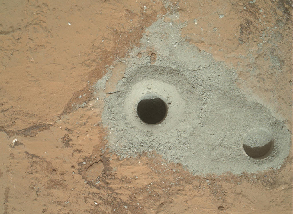
Our first set of 5 science papers on results from scooping martian dirt with Curiosity were published this week.  Those results and papers seem so old to me; we got the data late in 2012 and wrote the papers last spring.  We are working on more papers with more detailed results.  This will likely continue for years or maybe even decades - like the Viking analyses.  But the specifics are new to everyone not on the team.  The excitement from the broader community is so fun to see.

Reading the papers and talking about the results (MP3 interview on Insight) brings back interesting memories.  Most of them are good.  But it was also very hard to identify all of the things that had to be done before we could scoop and analyze the samples.  I was intimately involved in that process, and fellow Long Term Planner (LTP), Sanjeev Gupta, captured me working with sol paths and contingencies in one of our daily meetings with the Strategic Uplink Lead (SUL Alicia) and Strategic Science Planner (SSP Greg).

Long discussions often lead to better plans.
White boards are essential!
In operations, the LTP, SUL, SSP, and others representing engineering and science instruments meet near the end of every day at the Look Ahead Plan Meeting (LAPM), and often earlier in day at informal tag-ups.  We shape the plans for Curiosity for the upcoming 1-7 sols.  This is easy when we are mostly driving, but it was extremely challenging for our first sample.  There were so many things we didn't know.  We did our best to make good plans and revised them every day until we got our sample and our results.

I went through a similar process for Waypoint 1 / Darwin, but in that case, I was the Point of Contact for science planning.  Thus, I did a lot of the planning even when I wasn't the LTP.  It was great to have a LTP take care of the daily planning while I focused on other details.  We'll likely use this approach going forward when we get to a place where we want to do intensive work.  It gets easier each time.

When I started this mission, I had no idea what it takes to ask a rover on another planet to do science for you.  I now have some idea, but every time I sit down with someone with different expertise than mine, I realize how much they know and contribute that I'd never dreamed of.  For example, it took strategic planning plus three expert rover planners and me and instrument Payload Uplink Leads plus many others all day to plan the contact science for one day at Darwin.  And that is using tools developed that week in response to need identified from our last contact science adventure.  And... and... and...  Each time we do this, we know more, we improve our approaches, we build better tools.  I don't think it will ever be easy, though.  We will always push for more; it seems to be in our natures.

What an amazing adventure to be exploring Mars with Curiosity!

Monday, September 23, 2013

Waypoint 1 Mysteries

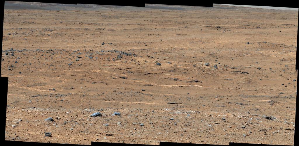
Over the last 4 weeks, I spent more than 100 hours preparing for our science campaign at "Waypoint 1", also called Darwin.  (See the official press release for a summary of results.) This is one of a handful of sites that we chose in advance to spend some extra time for contact science on our <as fast as possible> drive to the base of Mt. Sharp.  Along with Ken Williford, I volunteered to coordinate analyses at this first waypoint.  There were several key goals for this site.

First, we know that the rocks are very interesting and only a fews sols won't get us very far in understanding all the rocks in the area.  But we don't want to get bogged down in a long campaign of analyses because the base of Mt. Sharp is our prime science target.  Thus, Ken and I, with the help of many others, tried to put together a plan that included identifying the site for contact science, approaching the site, bumping to our contact science location, and doing 3 days of "outcrop" science.

Second, we wanted as much scientific information as possible in our short stay here. Maximizing science return is different for different people with different interests.  To start the planning off well, I encouraged the science team to identify the key science questions we could address at this site. Many team members stepped forward with presentations on scientific enigmas and the observations we needed to address them. We then settled on analyzing the composition and texture of conglomerates as our top science priority, with analyses of sandstones and mystery dark rocks as secondary targets.

Third, we decided that a good view is worth a lot, and there was a nice 3-m high, smooth hill with an amazing view of both the basin to the south of the official waypoint and what we hoped would be good areas to consider for contact science.

With these goals in mind, we headed toward the hill, named Panorama Point, expecting that it would not cost us any extra sols to get there rather than go straight to the contact science area. As luck would have it, full fledged AutoNav was approved the day before our drive toward Panorama Point, the terrain was perfect for a long AutoNav drive, and we got to almost the top with a record-breaking drive (141.5 m!). It was also right before a weekend, which meant we would have the weekend at the top of the hill for some stereo panoramic images, opportunistic contact science, and our approach to the contact science area.  On top of all that extra time at a great place (rather than a miscellaneous place), we got to our contact science area several sols earlier than we were planning!  This meant that Ken and I, and the rest of the team had to move into hyper planning mode, making decisions a week earlier than we expected.

This acceleration in schedule meant that we also got some extra science at the prime contact science location at no cost to drive progress beyond that already planned.  We were in what we call "restricted sols", which means that we only get our data down from Curiosity after we have to make a plan for the next day. This really slows us down when we are driving, because we can only drive every other sol. However, when we are doing contact science in one spot, we can do useful analyses every sol. Thus, I really wanted to get to the contact science area during restricted sols, which we did. That means that we could bump to one site and do some analyses while waiting for the data we needed to get to the second site (which had better outcrop in my opinion). Thus, we ended up with more contact science and two sites at the cost of no drive sols (or maybe 1 drive sol, depending on how you count).  This was a huge accomplishment for the team.  We took a record number of MAHLI images and did 8 analyses with APXS. And we left the site on schedule with no problems.  And we ended just as restricted sols ended.  Thus, we are back to Drive, Drive, Drive every day!

To see our data, check out the images at http://mars.jpl.nasa.gov/msl/multimedia/raw/?s=#/?slide=385 starting with sol 385 for tons of AutoNav drive images and going up to sol 402 with our last HazCam picture of the outcrop at site 2. Spend some time with 100's of images! And remember - they are from Mars!


No Methane on Mars

Late last week, a paper was published from our team that shows that there is very little methane in the martian atmosphere.  Methane is a really important gas that comes from biology on Earth as well as the reaction of hydrogen and carbon dioxide with iron-containing minerals without the help of biology.  If there is methane in the martian atmosphere, either life or one of these geological processes must be producing it, either of which would be interesting (but particularly if it was from life… which would take a lot of data to prove).  Ground-based telescopes have suggested that methane plumes might be released in the martian spring as the ground warms up.  Our results do not support that at all. Here are two really good articles describing our results, with slightly different perspectives:

Tuesday, September 10, 2013

Curiosity's Longest Drive Yet!

The "Darwin" Outcrop
Curiosity did its longest drive yet late last week: Press release.  It was beautiful!

I spent the last two weeks at the on-duty Long Term Planner, plus helping the team develop our science priorities for analyses at Waypoint 1, our first significant stop on the way to Mt. Sharp.  

It has been intensely rewarding to see the amazing images come down.  We chose this area as one of our 5 places to do more intense science because we expected reasonably good outcrop of the rocks that make up Bradbury Rise based on images from the orbiting instrument HiRISE.  And we chose well!  

Images: 
http://mars.jpl.nasa.gov/msl/multimedia/raw/?s=#/?slide=388 (more full frame images will come down over the next few days)


Sunday, August 25, 2013

Curiosity in 3D in KeckCAVES!

This video is in 3D, filmed using KeckCAVES software with a JPL CAD model of Curiosity


This is super cool, but my real dream is to have an animated Curiosity (e.g. turning wheels, pointing cameras, moving arm, etc.) to walk around with through Gale Crater and up the slopes of Mt. Sharp on real HiRISE and MastCam data!  It's close to possible - we just need a really good computer science graduate student and some $$ to pay them!

Saturday, August 24, 2013

Curiosity Update - On our way to Mt. Sharp with a bit of mudstone

It's been a while since I've posted anything.  It was a crazy-busy spring from me trying to teach as well as keep up with my work for the Mars Science Laboratory.  Now that we are halfway through summer, I'm feeling caught up.  I have time to focus on writing and editing papers, for MSL, my graduate students' projects, and our big Antarctic project.  It has been wonderful.

Here is a nice update from Colette, a great engineer I often work closely with:


Colette mentions that the science team will be releasing our results in the future.  I spent this morning editing our first paper on SAM results from the Yellowknife Bay mudstones.  The lead author is Doug Ming, and he plans to submit it to Science early next week.  It is so thrilling to see the plans for analyses turn into data and then interpretations.  Writing up the results forces us to critically evaluate what we've done and what the data mean.  It is satisfying to see how much we've learned!

Next Tuesday, I go back on shift as a Long Term Planner for almost 2 weeks.  During that time, we'll be driving, planning our next suite of science observations, and managing the data in our cameras.  It will be a busy two weeks.

Monday, March 11, 2013

Virtual Curiosity

We have a CAD model of Curiosity in KeckCAVES!

The University of California Office of the President, otherwise known as UCOP, has a PR campaign called Onward California.  They have "stories" about faculty members that are professionally filmed by The Department of the Fourth Dimension.  I am the focus on one of their 2013 stories, and two videos were recently released with me in the KeckCAVES with Curiosity, Earth, and Mars.

This is the "official" Onward California release:


And here is the one with lots of Curiosity:


Oliver Kreylos blogged about the filming of these videos - he was a great help as always!  His blog and YouTube channel are great places to go for the latest in useful virtual reality.  

JPL is the place to go for information on Curiosity.


Wednesday, December 12, 2012

A special post for Bill and Bruce

I was sitting in the Davis train station waiting for my train home, typing a summary of today's Science Discussion, when an old friend sat down across from me.  Bill Cotton!  A retired conductor and "legend of the Amtrak line", Bill knew everyone by name and still remembers most of us regular riders.  He said he is meeting Bruce, another conductor, tomorrow.  Bruce and I talked a lot about Mars when I first became part of the MastCam/MAHLI/MARDI camera team for Curiosity.  I gave Bill my blog address and asked him to pass it on to Bruce.  After talking a bit more, I said I'd add a link to the great images in the JPL press releases, so here it is, Bill:  http://mars.jpl.nasa.gov/msl/news/whatsnew/  It's so great to have run into you!

Now it's back to that summary of today's Science Discussion, with an even bigger smile on my face!

Monday, November 26, 2012

Engineers Talk EDL

I don't normally pay attention to GQ (the magazine, not another NASA acronym), but here's something you want to read:  http://www.gq.com/moty/2012/nasa-spacemen-of-the-year-2012  It's some of the MSL engineers reminiscing about Curiosity's landing.  Each adds their own take as they reconstruct the events.  It was an amazing night!

Friday, November 9, 2012

Dawn on Charlotte Talks, My NPR Interview

Curiosity's hand print in the soil of a wheel scuff.  The imprint is from the APXS instrument, which measured the elements (e.g. Si, Al, Mg, Fe, etc.) in the soil.

Earlier this week, I had the privilege of going to the annual Geological Society of America meeting in Charlotte, NC.  I presented our preliminary geological map of the Curiosity landing area in Gale Crater, Mars.

Thanks to Justin Samuel, of GSA, I was invited to record an hour-long NPR show with Mike Collins of Charlotte Talks.  It was great fun!  Here's the link: Mars Rover

Joy Cooke already posted a comment on the show asking if I encourage young students to pursue science (Thanks Joy!) - I do, but informally.  I try to share my experiences, but right now, I am almost entirely focused on making sure we use the rover for the best scientific purpose possible.  It's such a capable - and complicated - rover, that we have to have people dedicated to making all of the daily decisions on what to do - down to planning seconds, looking for swapped numbers, making tough choices about what to throw out of plans, etc.

For example, if a command has an error, it can put an instrument in an unsafe state. We then have to evaluate

  1. what happened, 
  2. whether or not any damage was done, 
  3. which data stored on Curiosity we need to request to diagnose the problem,
  4. how to fix the problem, 
  5. how to make up for the things Curiosity didn't do because of the error,
  6. how to change all the commands we were prepared to send to the rover (and make sure there aren't any new errors!)
  7. how to change the plan for the next day, 
  8. how to prepare for the Thanksgiving weekend (when most people actually get a holiday), and
  9. how to keep the problem from happening again
Yesterday, I worked over 12 hours on planning for the next few days plus Thanksgiving observations, and I wasn't the only one!  There were dozens of us.  

Eventually, we get to actually look at the amazingly cool data and learn something about Mars.  Often, the public has more time to look at the beautiful images than the people on the team!  I hope that all people of all ages can enjoy the sense of exploration, adventure, and discovery provided by the Curiosity rover!  It is an amazing international collaboration that people across the world can and should be proud of!

Saturday, November 3, 2012

Self Portrait of Curiosity!

We used MAHLI, the Mars Hand Lens Imager, to image Curiosity on Mars!  MAHLI is on the end of the arm, so to take the self portrait, we had to command the arm to move to a couple of dozen different places, pointing MAHLI precisely.  Several team members spent hours and hours preparing the sequence of images, testing it on Curiosity's Earth-bound twin, and then implementing it on Curiosity.  The result is spectacular, even in low resolution thumbnail mode!


Analyzing Mars

In the last week, we announced results from both of our large analytical instruments on Curiosity.


CheMin characterized the mineralogy of dust and sand at the site called Rocknest.  CheMin uses x-ray diffraction patterns to measure the spacing between atoms in crystals, which are diagnostic of specific minerals.  Some of the CheMin team members have been working for more than 2 decades to get x-ray diffraction on Mars!  This first sample analysis is a spectacular achievement.

Similarly, SAM characterized the composition of the martian atmosphere.  The SAM team looked for methane, a trace gas that some have suggested is present based on observations from Earth and a Mars orbiter.  However, those detections have been very controversial.  The SAM team announced that they did not detect martian methane in the atmosphere.  SAM did, however, refine estimates of the amount of 13C versus 12C in carbon dioxide as well as the concentration and isotopic ratios of argon.  These results are critical for understanding the history of the martian atmosphere, in particular why it is thin and how much of it might have been lost to space over the last several billion years.

SAM has not yet analyzed the dust and sand that CheMin has analyzed.  Those analyses are in the works and will represent another important milestone for our mission.

On a personal note, I'm heading to the annual meeting of the Geological Society of America.  There is a special session on results from the Mars Science Laboratory, and I'll be presenting our geological map on Monday morning.  It will be great to share our results with our colleagues!

Wednesday, October 17, 2012

Jake, Glenelg, and Mugearite


Here is a great blog about the fun of names on Mars, particularly the rock named Jake.  http://www.bbc.co.uk/news/19979798  

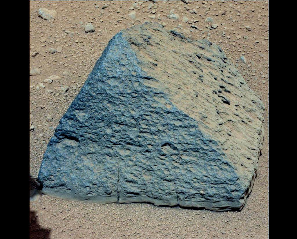
We name things on the MSL mission because it's easier to understand someone when they say "Jake" rather than "That rock we analyzed on sol, hummm, maybe sol 48.  The one that looked like a pyramid."  

Geologists do this with formations (groups of rocks) on Earth all the time.  Almost all formation names on Earth are taken from nearby places, a tradition also codified by official naming organizations such as the International Stratigraphic Commission.  We are now doing it on Mars, but we have to name the places before we can name the rocks.  

We're bootstrapping our way on the naming business.  First, we identified interesting geological formations on Earth that have the same name as a city with a population of <100,000 people.  We can then follow International Astronomical Union naming conventions and name a small crater after the city.  We then name the quad (a ~1.2 x 1.2 km2 area) containing the crater after the crater, which is named after the city, which has the same name as the geological formation, which is named after a place where the formation is found, which is named after a person, another place, or whatever it reminded the namer of...  This naming approach provides a very rich history from which people can make all sorts of interesting connections!  

I have to admit that the fact that we found mugearite on the way to Glenelg, both ultimately linked name-wise to the Isle of Skye, does seem like a "cosmic coincidence!"

Saturday, August 11, 2012

Be on Mars!

There are some very cool martian toys available that can give you a real sense of being with Curiosity on Mars.  First, you need to know what time it is, so you should get a Mars24 Sunclock.  When MSL is in the dark, we're hard at work!


Next, you can land with Curiosity at Eyes on the Solar System by choosing "replay".  Then there's the "LIVE Mode" button that you can use to follow along on our mission!  The simulation that you see was scripted before landing and was only 0.6 seconds off in time.  They didn't get exactly the right landing site, though.  This will be corrected in the next week or so.  I think that the site will follow Curiosity during the entire mission!  What fun!

Friday, August 10, 2012

Quad 51: Yellowknife

I had a bit of fun yesterday...  I participated in a JPL press conference, and I was supposed to describe our mapping work on the team, which I've been co-chairing with John Grant. Fred Calef is doing all the hard work.  This effort has been going on for about a month before landing.  We solicited volunteers from the science team to each map a 1.3x1.3 km quad in or near the landing ellipse.  The volunteers submitted their maps, and we've been integrating them into a single map.  In our mission work, we are refining our efforts and developing models for how the different rock types formed.  It's been an amazingly fun project.

In addition to describing the mapping effort, I was going to announce the name of the quad we landed in - it happened to be one of the ones I mapped.  However, at the last minute, we decided to postpone the announcement.  Thus, I talked about Quad 51.  No one on the team had noticed - or at least said anything - about this coincidence.  Immediately, the press, however, picked up on "Area 51".  We landed in Area 51!  Total coincidence!

The name Yellowknife was announced after the press conference.  That now has people running around explaining why we chose Yellowknife, which I had planned to do in the press conference!  So here's a bit about why:

For the Geologists:  The Yellowknife Supergroup consists of rocks that are about 2.7 billion years old.  They form a greenstone belt (Sasha and the UCD Geology Club - they include one schist, two schist, green schist, but no blue schist.) that overlies the oldest rocks in the world, the 4.98 billion year old Acasta Gneiss.

For the Historians and Geologists, who are after all, historians of the earth:  Yellowknife is the largest town in the Northwest Territories with a population of a little less than 20,000 people.  It is named after the Yellowknife Dene who live in the area and used to make knives out of copper.  In the 1930's, Yellowknife was a gold and uranium boom town, and in the 1990's it was the center of a diamond rush.  Many geologists and arctic explorers go through Yellowknife on their way north.  Thus, the town holds many interesting memories for a number of people on the team, including John Grotzinger, the Project Scientist, who is the one who chose the name.

Congratulations to Yellowknife!

Back to the topic of Area 51: The team loves it, as do the engineers.  In today's press conference, one of them talked about all the strange things that happened in Quad 51.  It couldn't have been better!

Tuesday, August 7, 2012

Great Mashup Video of Landing

Watch and enjoy!


During landing, I was watching the plot of doppler shifts for Curiosity's tones, sent direct to earth.  The doppler shift says how fast the spacecraft was moving relative to earth.  I saw a sudden drop in doppler shift, just before they announced the parachute deploy - it was dramatic!  I knew immediately that the parachute was doing something because nothing else would slow down the decent that quickly.  Once earth set behind the crater rim, we no longer had a signal and relied on Odyssey for all "real-time" data.  That's one of the reasons there was so much cheering when we heard that Odyssey and Curiosity were talking.

Science, Science, Science!

The first MAHLI image came down!  This is our microscopic imager that can also focus at a distance.  This image was taken through the dust cover of MAHLI, and we kicked up a lot of dust on landing.  Thus, the image is not as sharp as we will see later in the mission.  However, it is really beautiful and reminds me of the Smokey Mountains!  Although the color is different - and this is true color, taken with an RGB imaging chip!  Welcome to Mars, the Red Planet - or maybe orangey-yellow planet.  Just wait until we get that dust cover off or the first pictures with the color MastCams!

Ken Edgett describing the first MAHLI image from Curiosity.  You can see a distinctive peak on the crater rim!  This image reminds me of the Smokey Mountains!  Although the color is a bit different - Welcome to Mars, the Red Planet!  From AP Photo.


The science efforts are really heating up.  We've been working on mapping the geology and geomorphology of Curiosity's landing area using data from orbiters.  These data are amazing!  And when you have a hundred people looking at the same areas, lots of observations get made.  I've worked with several others to compile maps made by ~20 volunteers.  We are now at the stage of identifying better units for one of the particularly interesting rock types.  We'll have a detailed discussion about how we want to map that unit starting at 1 am!  It's absolutely fantastic!

Monday, August 6, 2012

Color Movie of Landing on Mars

The MARDI camera took the very first movie of landing on Mars, and we got more than 100 thumbnail images back from it this morning.  It's in color!  We'll have higher resolution soon!

http://www.nasa.gov/multimedia/videogallery/index.html?media_id=149974611

We're there! And now it's time for SCIENCE

We landed!  It couldn't have been better or more successful!  Nothing (!!!) went wrong, except the A/V system in the Science Discussion room was stuck in "show NASA TV" mode from the landing.  We could still talk, though!

I finished my shift as Long Term Planner at 9:30 in the morning.  I went home and immediately fell asleep for 9 long hours.  I woke up just in time to watch the sunset.  In reading my e-mail, I've learned that we got a lot more data while I was out.  I'm eager to get back in, see where we landed, and dive back into the science.

UCDavis compiled a list of links to media coverage of me, which Louise sent around.  Here's that list:


Outlet: BBC News
Title: Gale Crater: Geological 'sweet shop' awaits Mars rover
Publication Date: 08/03/2012
Summary: BBC News interviews geology professor Dawn Sumner about the Mars rover mission: "I am confident we will learn amazing new things. Some of them will be answers to questions we already have, but most of what we learn will be surprises to us."
Unique Visitors Per Month: 8,696,910

Outlet: Nature
Title: Crater Mound a Prize and Puzzle for Mars Rover
Publication Date: 08/03/2012
Summary: Many researchers have differing theories regarding the formation of the mysterious Mount Sharp on Mars, but Dawn Sumner is not concerned with these differences. "That's what the mission is for," she says. "We have a million different opinions among 250 people."
Unique Visitors Per Month: 1,862,094

Outlet: Sacramento Bee
Title: Mars Rover Success Could Lift Future Missions
Publication Date: 08/05/2012
Summary: The Sacramento Bee interviews Dawn Sumner about the Mars rover mission: "It will be an adrenaline rush, but I tend to be an optimist." As co-investigator, Sumner is in charge of culling information from data sent back from the rover. "We will be looking for rocks that are 3 billion years old," she said.
Unique Visitors Per Month: 1,158,680

Outlet: Sacramento Bee
Title: Video: UC Davis Professor Dawn Sumner Speaks About the Mars Rover Mission
Publication Date: 08/05/2012
Summary: Before the Mars rover "Curiosity" landed on the planet Sunday night, UC Davis professor Dawn Sumner discussed its mission and landing.
Unique Visitors Per Month: 1,158,680

Outlet: Davis Enterprise
Title: UC Davis Scientist Prepares for Mars Rover Landing
Publication Date: 08/05/2012
Summary: Geology professor Dawn Sumner will spend the first four "Martian" days as the "long-term planner" of the Mars rover team, coordinating the first scientific interpretations of what is seen when the rover lands and helping make daily decisions about Curiosity's activities.
Unique Visitors Per Month: 17,332

Outlet: KCOP-TV
Title: Fox News at 11
Air Date: 08/05/2012
Summary: Fox 11 was at the Jet Propulsion Laboratory in Pasadena, California where UC Davis geologist Dawn Sumner celebrated the successful Mars rover landing with her colleagues and discussed the mission's purpose.
Nielsen Audience: 32,410

Outlet: Hearst Television Inc.
Title: KCRA News
Air Date: 08/06/2012
Summary: Dawn Sumner was among the many viewers watching the Mars rover landing on Sunday night, preparing for her next four days of crucial work to uncover the scientific meaning of the rover's discoveries.
Nielsen Audience: 14,594

Outlet: Capital Public Radio
Title: Mars Rover Will Have UC Davis Professor at Controls
Publication Date: 08/02/2012
Summary: Dawn Sumner was picked for her position on the Mars mission because of her experience searching for life forms in Antarctica, the place on earth that may be most like Mars. Speaking with CPR, Sumner says the evidence of life her team is looking for is very, very small.
Unique Visitors Per Month: 16,016

Outlet: Planet Save
Title: Mars Rover Curiosity Will Explore Strange Crater
Publication Date: 08/05/2012
Summary: NASA's Mars Rover Curiosity is set to land on Mars and explore Mount Sharp, a 5.5-km-tall mound of layered sediments that time and pressure have squeezed into a mountain of rock, strangely located in the center of the large Gale crater. Dawn Sumner refers to it as a "scientific enigma."
Unique Visitors Per Month: 31,686

Outlet: Dawn on Mars (Professor Sumner's personal blog)
Title: How to do Science with 300+ Team Members and a Rover on Another Planet
Publication Date: 08/05/2012
Summary: Geology professor Dawn Sumner has written a blog post describing her work with the Mars rover "Curiosity" and the purpose of their mission.
Unique Visitors Per Month: N/A