The shutdown has yet to affect Curiosity operations except for the fact that those of us who are not government employees are taking operational shifts for those who are. However, the shutdown affects a lot of other things.
I have been planning for a research trip to Antarctica, and that is likely cancelled (but no one has been able to confirm this since everyone who could is on furlough). Please see my blog entry for Dawn In Antarctica for my state of mind the last 2 weeks: http://dawninantarctica.blogspot.com/2013/10/shutdown.html
Sunday, October 13, 2013
Saturday, September 28, 2013
Planning Curiosity's First Scoop
Our first set of 5 science papers on results from scooping martian dirt with Curiosity were published this week. Those results and papers seem so old to me; we got the data late in 2012 and wrote the papers last spring. We are working on more papers with more detailed results. This will likely continue for years or maybe even decades - like the Viking analyses. But the specifics are new to everyone not on the team. The excitement from the broader community is so fun to see.
Reading the papers and talking about the results (MP3 interview on Insight) brings back interesting memories. Most of them are good. But it was also very hard to identify all of the things that had to be done before we could scoop and analyze the samples. I was intimately involved in that process, and fellow Long Term Planner (LTP), Sanjeev Gupta, captured me working with sol paths and contingencies in one of our daily meetings with the Strategic Uplink Lead (SUL Alicia) and Strategic Science Planner (SSP Greg).
In operations, the LTP, SUL, SSP, and others representing engineering and science instruments meet near the end of every day at the Look Ahead Plan Meeting (LAPM), and often earlier in day at informal tag-ups. We shape the plans for Curiosity for the upcoming 1-7 sols. This is easy when we are mostly driving, but it was extremely challenging for our first sample. There were so many things we didn't know. We did our best to make good plans and revised them every day until we got our sample and our results.
I went through a similar process for Waypoint 1 / Darwin, but in that case, I was the Point of Contact for science planning. Thus, I did a lot of the planning even when I wasn't the LTP. It was great to have a LTP take care of the daily planning while I focused on other details. We'll likely use this approach going forward when we get to a place where we want to do intensive work. It gets easier each time.
When I started this mission, I had no idea what it takes to ask a rover on another planet to do science for you. I now have some idea, but every time I sit down with someone with different expertise than mine, I realize how much they know and contribute that I'd never dreamed of. For example, it took strategic planning plus three expert rover planners and me and instrument Payload Uplink Leads plus many others all day to plan the contact science for one day at Darwin. And that is using tools developed that week in response to need identified from our last contact science adventure. And... and... and... Each time we do this, we know more, we improve our approaches, we build better tools. I don't think it will ever be easy, though. We will always push for more; it seems to be in our natures.
What an amazing adventure to be exploring Mars with Curiosity!
Reading the papers and talking about the results (MP3 interview on Insight) brings back interesting memories. Most of them are good. But it was also very hard to identify all of the things that had to be done before we could scoop and analyze the samples. I was intimately involved in that process, and fellow Long Term Planner (LTP), Sanjeev Gupta, captured me working with sol paths and contingencies in one of our daily meetings with the Strategic Uplink Lead (SUL Alicia) and Strategic Science Planner (SSP Greg).
 |
| Long discussions often lead to better plans. |
 |
| White boards are essential! |
I went through a similar process for Waypoint 1 / Darwin, but in that case, I was the Point of Contact for science planning. Thus, I did a lot of the planning even when I wasn't the LTP. It was great to have a LTP take care of the daily planning while I focused on other details. We'll likely use this approach going forward when we get to a place where we want to do intensive work. It gets easier each time.
When I started this mission, I had no idea what it takes to ask a rover on another planet to do science for you. I now have some idea, but every time I sit down with someone with different expertise than mine, I realize how much they know and contribute that I'd never dreamed of. For example, it took strategic planning plus three expert rover planners and me and instrument Payload Uplink Leads plus many others all day to plan the contact science for one day at Darwin. And that is using tools developed that week in response to need identified from our last contact science adventure. And... and... and... Each time we do this, we know more, we improve our approaches, we build better tools. I don't think it will ever be easy, though. We will always push for more; it seems to be in our natures.
What an amazing adventure to be exploring Mars with Curiosity!
Monday, September 23, 2013
Waypoint 1 Mysteries
Over the last 4 weeks, I spent more than 100 hours preparing for our science campaign at "Waypoint 1", also called Darwin. (See the official press release for a summary of results.) This is one of a handful of sites that we chose in advance to spend some extra time for contact science on our <as fast as possible> drive to the base of Mt. Sharp. Along with Ken Williford, I volunteered to coordinate analyses at this first waypoint. There were several key goals for this site.
First, we know that the rocks are very interesting and only a fews sols won't get us very far in understanding all the rocks in the area. But we don't want to get bogged down in a long campaign of analyses because the base of Mt. Sharp is our prime science target. Thus, Ken and I, with the help of many others, tried to put together a plan that included identifying the site for contact science, approaching the site, bumping to our contact science location, and doing 3 days of "outcrop" science.
Second, we wanted as much scientific information as possible in our short stay here. Maximizing science return is different for different people with different interests. To start the planning off well, I encouraged the science team to identify the key science questions we could address at this site. Many team members stepped forward with presentations on scientific enigmas and the observations we needed to address them. We then settled on analyzing the composition and texture of conglomerates as our top science priority, with analyses of sandstones and mystery dark rocks as secondary targets.
Third, we decided that a good view is worth a lot, and there was a nice 3-m high, smooth hill with an amazing view of both the basin to the south of the official waypoint and what we hoped would be good areas to consider for contact science.
With these goals in mind, we headed toward the hill, named Panorama Point, expecting that it would not cost us any extra sols to get there rather than go straight to the contact science area. As luck would have it, full fledged AutoNav was approved the day before our drive toward Panorama Point, the terrain was perfect for a long AutoNav drive, and we got to almost the top with a record-breaking drive (141.5 m!). It was also right before a weekend, which meant we would have the weekend at the top of the hill for some stereo panoramic images, opportunistic contact science, and our approach to the contact science area. On top of all that extra time at a great place (rather than a miscellaneous place), we got to our contact science area several sols earlier than we were planning! This meant that Ken and I, and the rest of the team had to move into hyper planning mode, making decisions a week earlier than we expected.
This acceleration in schedule meant that we also got some extra science at the prime contact science location at no cost to drive progress beyond that already planned. We were in what we call "restricted sols", which means that we only get our data down from Curiosity after we have to make a plan for the next day. This really slows us down when we are driving, because we can only drive every other sol. However, when we are doing contact science in one spot, we can do useful analyses every sol. Thus, I really wanted to get to the contact science area during restricted sols, which we did. That means that we could bump to one site and do some analyses while waiting for the data we needed to get to the second site (which had better outcrop in my opinion). Thus, we ended up with more contact science and two sites at the cost of no drive sols (or maybe 1 drive sol, depending on how you count). This was a huge accomplishment for the team. We took a record number of MAHLI images and did 8 analyses with APXS. And we left the site on schedule with no problems. And we ended just as restricted sols ended. Thus, we are back to Drive, Drive, Drive every day!
To see our data, check out the images at http://mars.jpl.nasa.gov/msl/multimedia/raw/?s=#/?slide=385 starting with sol 385 for tons of AutoNav drive images and going up to sol 402 with our last HazCam picture of the outcrop at site 2. Spend some time with 100's of images! And remember - they are from Mars!
No Methane on Mars
Late last week, a paper was published from our team that shows that there is very little methane in the martian atmosphere. Methane is a really important gas that comes from biology on Earth as well as the reaction of hydrogen and carbon dioxide with iron-containing minerals without the help of biology. If there is methane in the martian atmosphere, either life or one of these geological processes must be producing it, either of which would be interesting (but particularly if it was from life… which would take a lot of data to prove). Ground-based telescopes have suggested that methane plumes might be released in the martian spring as the ground warms up. Our results do not support that at all. Here are two really good articles describing our results, with slightly different perspectives:
Tuesday, September 10, 2013
Curiosity's Longest Drive Yet!
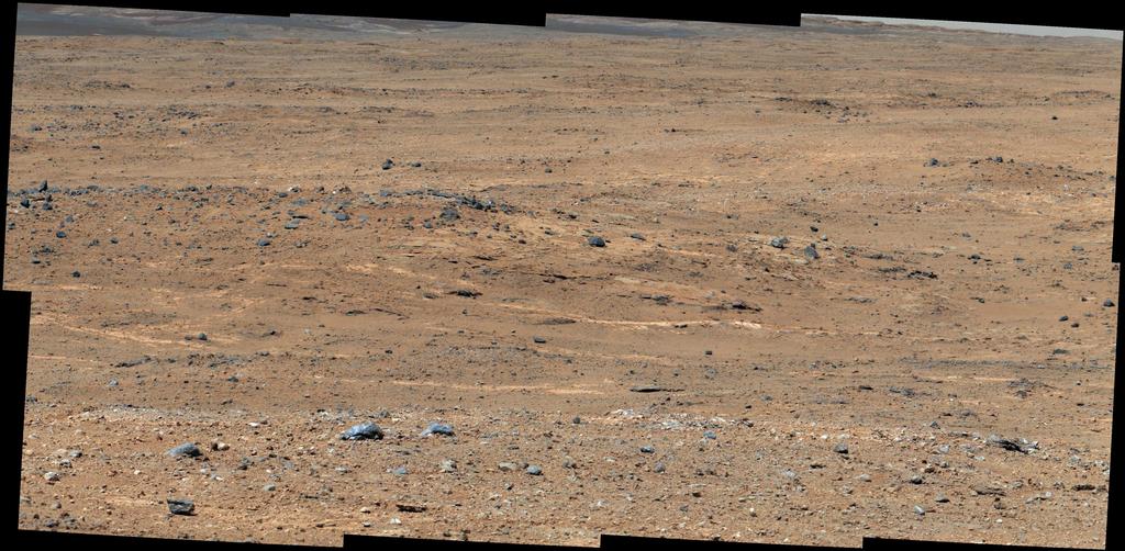 |
| The "Darwin" Outcrop |
Curiosity did its longest drive yet late last week: Press release. It was beautiful!
I spent the last two weeks at the on-duty Long Term Planner, plus helping the team develop our science priorities for analyses at Waypoint 1, our first significant stop on the way to Mt. Sharp.
It has been intensely rewarding to see the amazing images come down. We chose this area as one of our 5 places to do more intense science because we expected reasonably good outcrop of the rocks that make up Bradbury Rise based on images from the orbiting instrument HiRISE. And we chose well!
Images:
http://mars.jpl.nasa.gov/msl/multimedia/raw/?s=#/?slide=388 (more full frame images will come down over the next few days)
Sunday, August 25, 2013
Curiosity in 3D in KeckCAVES!
This is super cool, but my real dream is to have an animated Curiosity (e.g. turning wheels, pointing cameras, moving arm, etc.) to walk around with through Gale Crater and up the slopes of Mt. Sharp on real HiRISE and MastCam data! It's close to possible - we just need a really good computer science graduate student and some $$ to pay them!
Saturday, August 24, 2013
Curiosity Update - On our way to Mt. Sharp with a bit of mudstone
It's been a while since I've posted anything. It was a crazy-busy spring from me trying to teach as well as keep up with my work for the Mars Science Laboratory. Now that we are halfway through summer, I'm feeling caught up. I have time to focus on writing and editing papers, for MSL, my graduate students' projects, and our big Antarctic project. It has been wonderful.
Here is a nice update from Colette, a great engineer I often work closely with:
Colette mentions that the science team will be releasing our results in the future. I spent this morning editing our first paper on SAM results from the Yellowknife Bay mudstones. The lead author is Doug Ming, and he plans to submit it to Science early next week. It is so thrilling to see the plans for analyses turn into data and then interpretations. Writing up the results forces us to critically evaluate what we've done and what the data mean. It is satisfying to see how much we've learned!
Next Tuesday, I go back on shift as a Long Term Planner for almost 2 weeks. During that time, we'll be driving, planning our next suite of science observations, and managing the data in our cameras. It will be a busy two weeks.
Subscribe to:
Posts (Atom)